Aircraft Rerouting for Reduced Climate Impact (ARRCI)
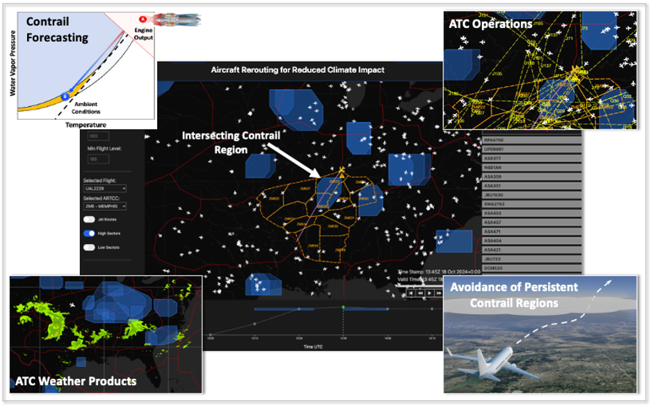
Condensation trails, or “contrails,” are the tracks of ice crystals that form behind aircraft when the ambient conditions lead to the freezing of water vapor produced by jet fuel combustion. Environments high in atmospheric moisture support contrails that can persist for extended durations, sometimes lasting several days. Persistent contrails are a significant climate concern because they have been shown to exert a net warming effect on the atmosphere. Although the science of contrail impacts continues to be refined, the latest studies suggest contrails may account for up to 60% of the warming impact from the commercial aviation sector, putting the climate influence of contrails potentially above even that of aircraft carbon dioxide (CO₂) emissions.
To reduce climate impacts of civil aviation, there is increasing interest in the development of technologies to mitigate persistent contrails. Implementing contrail avoidance at a system-wide level necessitates the integration of air traffic control (ATC) in developing climate-optimized flight trajectories accounting for contrails, CO₂ and other non-CO₂ impacts. However, existing contrail forecasting methods lack the skill and fidelity needed to predict persistent contrail regions at an operationally-actionable level. Additionally, current ATC systems lack the decision-support infrastructure to effectively identify and propose actions to reduce contrail impacts.
The ARRCI initiative builds on cutting-edge research in the Air Traffic Control and Weather Systems Group at Lincoln Laboratory and the Laboratory for Aviation and the Environment (LAE) in MIT AeroAstro. By leveraging machine learning models trained on satellite imagery and numerical weather data, ARRCI is improving the state of the art with respect to detecting and predicting regions prone to contrail persistence. A prototype web tool is also being developed that can present these contrail regions alongside conventional ATC weather and operational data, enabling ATC to explore how to incorporate sustainability considerations alongside traditional operational priorities when routing aircraft.
Related
News

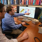
Q&A with Vijay Gadepally on the climate impact of generative AI

44 years ago, this Utah national monument made history